 . . .
. . . 
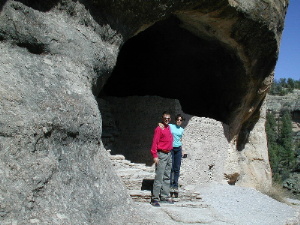
Gila Cliff Dwellings: where the Mogollon (pronounce 'moggy own') lived for about 100 years. / Hier wohnten die Mogollon (wird "Moggijon" ausgesprochen) ca. 100 Jahre lang.
back to homepage / zurück zur Homepage
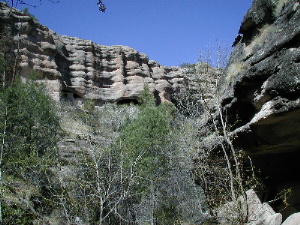
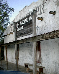
22.04.00 After driving approx. 3 1/2 hours, we reached the Gila Cliff Dwellings National Monument southeast of Silver City. The cliff dwellers were ancestral Puebloan people (the Mogollon) who built their homes in natural caves. The cliff dwellings date to the late 1200s. Five of seven natural caves high in the cliff of a side canyon contain the ruins of dwellings - a total of about 40 rooms, most of it you can visit. Walking back to the parking lot, we again encountered a snake on the trail, this time a gopher, as we learnt later, a very common snake all over the country. On our way to Lordsburg we stopped at tiny Pinos Altos for diner at the Buckhorn Saloon. We were even able to take a look at the adjacent opera house. Volker was in so good shape that he still drove this evening on to Lordsburg whereas I slept all the way down there...
22.04.00 Nach ca. 3 1/2 Stunden Fahrt erreichten wir das Gila Cliff Dwellings National Monument südöstlich von Silver City. Die Mogollon-Indianer haben Ende des 12. Jh ihre Häuser in natürlichen Höhlen gebaut. Fünf von sieben natürliche Höhlen über einem (übrigens malerischen) Canyon beinhalten Ruinen, insgesamt 40 Räume, die man fast alle besichtigen kann. Auf unserem Weg zurück zum Auto, auf dem Wanderweg, befand sich wieder eine Schlange, diesmal keine Klapperschlange, sondern eine Gopher Snake, wie wir später erfuhren, eine sehr verbreitete Art im ganzen südlichen Teil des Landes. Der Weg in Richtung Lordsburg von Gila Cliffs führte über das Dörfchen Pinos Altos, ein früheres Minenstädtchen. Dort haben wir im Buckhorn Saloon zu Abend gegessen und das Glück gehabt, in das nebenstehende Opera House einen Blick zu werfen. Volker war noch so gut drauf, daß er bis Lordsburg gefahren ist, während ich die ganze Fahrt nur gepennt habe...
. . .
Gila Cliff Dwellings: where the Mogollon (pronounce 'moggy own') lived
for about 100 years. / Hier wohnten die Mogollon (wird "Moggijon"
ausgesprochen) ca. 100 Jahre lang.
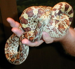 Gopher Snake
 . . . . .
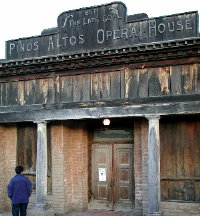
The Buckhorn Saloon; Opera House in Pinos Altos, New Mexico.
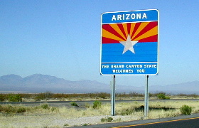
23.04.00 Today we passed from the state of New Mexico to Arizona. We drove down the road leading to Chiricahua National Monument and stopped at the trailhead of Fort Bowie. So we hiked the trail up to what remains of Fort Bowie going through the Apache Pass. What I most enjoyed was the gentleman at the Visitors Center (a volunteer) who was knowledgeable about everything related to the Indians, especially the Apaches. What happened again to us on our walk? There was a patch-nosed snake on our way... In the afternoon we reached Chiricahua National Monument and relaxed with barbeque etc.
23.04.00 Heute sind wir in den Staat Arizona reingefahren. Auf unserem Weg zum Chiricahua National Monument haben wir einen Stopp am Wanderweg eingelegt, der zu Fort Bowie über den Apache Pass führt. Am meisten war ich begeistert von dem ehrenamtlichen Mitarbeiter im Besucherzentrum, denn er kennt sich sehr gut mit den Apache-Indianern aus. Was ist uns natürlich auf dem Wanderweg passiert? Ja, erraten, wir hatten wieder eine Schlange auf dem Weg, eine Patch-Nosed Snake... Nach der Anfahrt durch vegetationsarme Trockenzonen überrascht der dichte Baumbestand des Coronado Forest im Chiricahua National Monument, wo wir auf dem Campingplatz erstmal ausgespannt und natürlich gegrillt haben.
 . . . . .
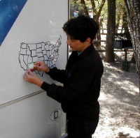
... a new sticker on our map / ein neuer Aufkleber auf unserer
USA-Karte!
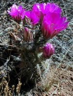 Barrel Cactus
 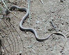 Western Patch-Nosed Snake
24.04.00 We got up early, for a shuttle was to fetch us at 8:35 a.m. in the Campground to drive us up to a trailhead near Massai Point. We were now waiting over 20 minutes and thought maybe they forgot us. Volker gave the park headquarters a call and they told him it was 7:55 a.m. and not 8:55 a.m. Unlike New Mexico, Arizona is not on daylight savings time -except the Navajo Indian Reservation as we found out later. Our shuttle brought us up to the Echo Canyon trailhead (ca. 2100 m). From there we began our hike along the Echo Canyon. Through the Mushroom Trail and the Inspiration Point (including the Hard Rock Loop) we walked way down to the valley and were granted fantastic views on the strangely eroded volcanic geology (6 hours).
24.04.00 Wir sind heute früh aufgestanden, denn ein Shuttle-Bus sollte uns um 8.35 Uhr am Campingplatz abholen, um uns in die Nähe vom Massai Point zu fahren. Nachdem wir 20 Minuten dort gestanden haben und sich nichts tat, hat Volker bei der Nationalpark-Zentrale angerufen. Dabei erfuhr er, daß es erst 7.55 Uhr war! Im Gegensatz zu New Mexico hat Arizona keine Sommerzeit. Allerdings ist im Bereich des Navajo Indianerreservat in Arizona die Sommerzeit eingeführt! Als es dann wirklich 8.35 Uhr war, kam auch ein Van und fuhr uns hoch zum Wegbeginn des Echo Canyon (ca. 2100 m). Von dort aus sind wir mit einigen Umwegen u.a. über den Inspiration Point, Hard Rock Loop bis runter zum Tal gelaufen und wurden mit fantastischen Ausblicke auf die bizarre Landschaft belohnt (6 Stunden).
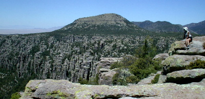 Inspiration Point, Chiricahua National Park, Arizona
 . . .
. . .
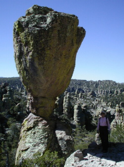
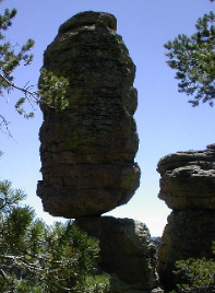 Chiricahua National Monument, Arizona: Echo Canyon and Pinnacle
Balanced Rock
Chiricahua National Monument, Arizona: Echo Canyon and Pinnacle
Balanced Rock
back to homepage / zurück zur Homepage
to previous page / zur vorigen Seite . . . to next page / zur nächsten Seite